In short
Canada Topo Maps Pro is a mapping app for Android created by ATLOGIS Geoinformatics oHG. It can be recommended to adventurers. And this is a perfect way to use while adventuring.
Highlights
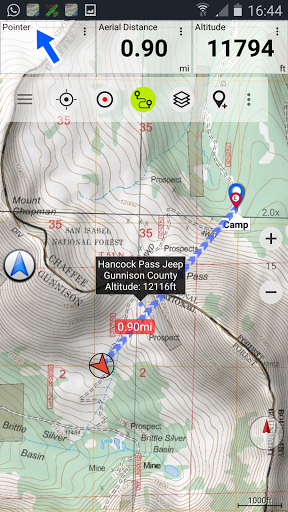
And the GPS functions and trip master are very good
Ability to export and then map it on Google earth is fantastic
Great mapping app which I use when cycling
Thanks very much for continuing to develop this app
Great quality maps in nts format great for back country and downtown
Great app for adventurers
I love it and it's a great tool to use while adventuring
The map detail is pretty good and seamless
Works great on my Samsung Galaxy 10
This is a great app for hiking
I NEEDED TO UNINSTALL MY DEVICE ANTIVIRUS IN ORDER TO GET IT TO WORK
I click the map cache button but it's greyed out
You can't continue recording a track you began a previous day
Many other maps are extremely outdated as well
And fails when I try to delete the partly downloaded ones
It fails when I try to cache large maps
The most recent update to come out won't install
They don't value their customers
Paid way to much money for this app Online or offline the maps won't load
Previous version had this feature
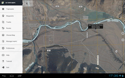
Description
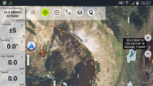
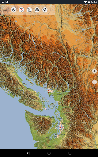
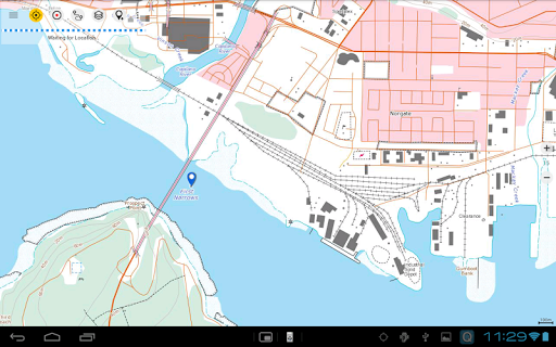
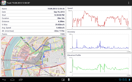
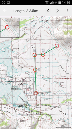
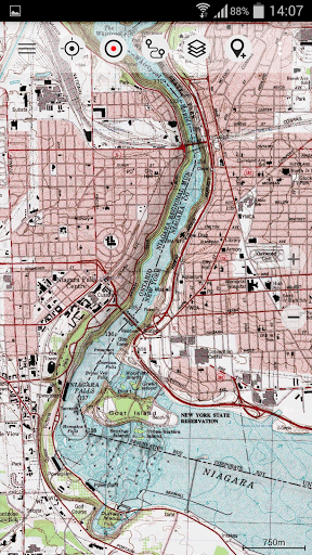
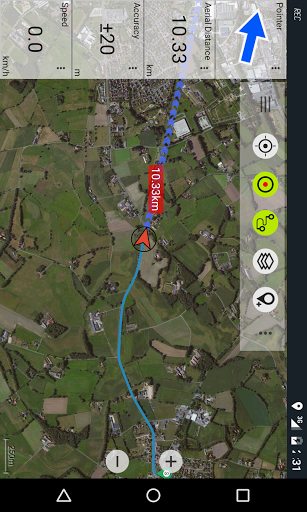
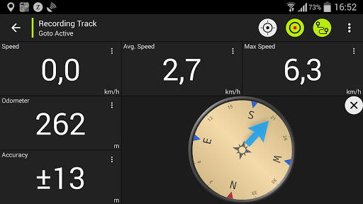
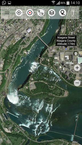
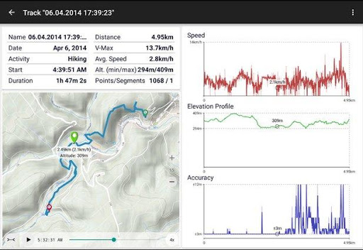
Easy to use outdoor/offline navigation app with the best topographic maps of Canada. This app gives you similar mapping options as you might know from Garmin or Magellan GPS handhelds. *** Attention: Please use Toporama or Canada Base Map layer if you need most recent topo maps ! *** Main features for outdoor-navigation: • Bulk-download of map tiles for OFFLINE USAGE (not for Google and Bing maps) • Create and edit Waypoints • GoTo-Waypoint-Navigation • Create and edit Routes • Route-Navigation (Point-to-Point Navigation) • Track Recording (with speed, elevation and accuracy profile) • Tripmaster with fields for odometer, average speed, bearing, elevation, etc. • GPX-Import / Export, KML-Export • Search (placenames, POIs, streets) • Customizable datafields in Map View and Tripmaster (e.g. Speed, Distance, Compass, ...) • Share Waypoints, Tracks or Routes (via eMail, Facebook, ..) • Use Coordinates in UTM, WGS84 or MGRS • and many more ... Available map layers: • Topomaps Canada (CanMatrix, seamless coverage at scales 1:50.000 and 1:250.000) • Toporama Maps Canada (CanVec, NTDB, Atlas of Canada) • Canada Basemap (CanVec, NTDB, Atlas of Canada) • CanTopo (new Canada topos at 1:50.000, partial coverage of Can) • Google Maps (Satellite images, Road- and Terrain-Map) • Bing Maps (Satellite images, Road-Map) • Open Street Maps (OSM Mapnik and Cloudemade Cyclemap) • Hillshading overlay layer for OSM, Google, Bing or Toporama maps Toporama Maps Canada: These are the most recent topographic maps of Canada. Can be enhanced with hillshading overlay. Topomaps Canada: These maps contain many small pathes and 4WD tracks that are missing in Toporama, Google, Bing and OSM maps. This layer is essential for real outdoor and offroad trips in Canada. Seamless mosaic of more than 13.000 collar clipped 1:50.000 maps. Use this navigation app for outdoor activities like hiking, biking, camping, climbing, riding, skiing, canoeing or offroad 4WD tours. Preload FREE map data for areas without cell service. Canadian topographic maps are enhanced with Atlogis hillshading and placenames. Credits for topographic map data: "Department of Natural Resources Canada. All rights reserved."Please send comments and feature requests to canadamaps@atlogis.com
More