Free

Sky MET - Aviation Meteo FREE

126 ratings DOWNLOAD

In short

Sky MET - Aviation Meteo FREE is a free app for Android created by Sparkling Apps.

Highlights

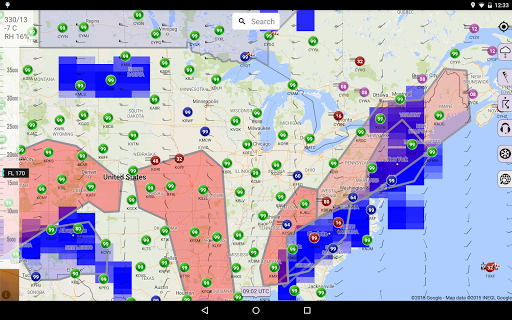
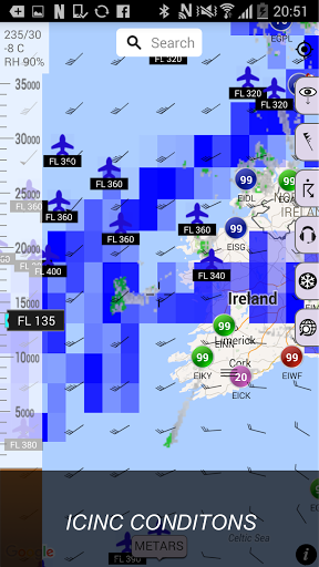
Long range flights meteo infos are now more easily collectable

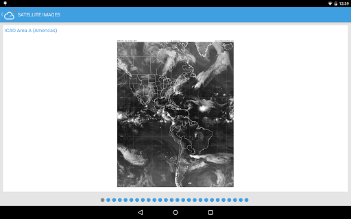
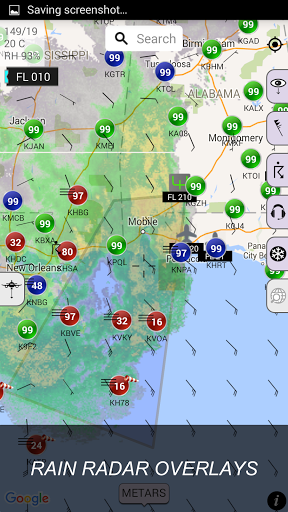
Amazing full Globe coverage

You created a great app

I quite enjoy it Thank you for your great efforts

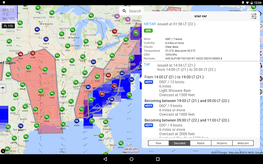
Webcams are great plus

Favorites is good for a specific flight

Or wind data use white circle as green is misleading

Past few days program is not working

This is the most deceiving app EVER

Impossible to check the reports previousely loaded if no coverage

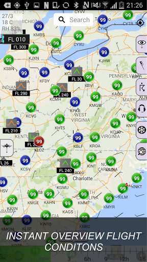
FL Data in top left corner is just showing zeros for all now

Description

Sky MET: The ultimate weather app for pilots, by pilots. From the developer of Aeroweather Android come this visually stunning and feature rich application. It provides you with all the weather information you will need when you prepare for your next flight: METARs and TAFs with a twist: Sure, you can get TAFs and METARs everywhere, but you'd be hard pressed to find a map based over overview that provides you instant insight in how the weather will develop over time, just by moving a slider. In addition to raw text, Sky MET provides you with: - TAF and METAR decoding - Crosswind component calculation - Weather radar for each station - Station NOTAMS - And web cam images, allowing for a sneak peek at the station sky Available after purchase of the pro version: Wind Aloft Quickly see what the winds will be like for any altitude between ground and FL 440 SIGMETs, AIRMETs and outlooks Unlike most other weather apps, Sky MET presents you with the full range of international Sigmets and airmets required when preparing for your next trip, and when moving the time slider Sky MET will also provide a sigmet outlook. Affected regions are drawn on the map along with the station summaries. You filter on any combination of: - Sigmets - Outlooks - Tango Airmets - Sierra Airmets - ICE airmets PIREPs Use Sky MET to quickly see all PIREPs for the last hour. For your convenience the reports have been categorised in Turbulence, Icing and other PIREPs. Urgent pilot reports, for instance when reporting low level wind shear or heavy icing conditions, are clearly marked in red. Clouds, ICE and tops Sky MET calculates the areas with relatively high cloud density. These areas are displayed in on the map where blue and yellow coloration's indicate the likelihood of icing conditions. By sliding the altitude bar you can pick an altitude that is less affected by icing conditions. A quick glance in the left hand top corner of the screen show you the forecasted ambient temperature, wind and relative humidity. The latter you determine weather or not clouds will be likely at that position and altitude. Sat images and analysis. Satellite images and significant weather charts are provided to complete the weather picture. Good luck with Sky MET. Please contact us for any issues or suggestions.
More

Similar Apps

Cookies help us deliver our services. By using our services, you agree to our use of cookies. Learn more