In short
Tidal Currents Trip Planner is an app for Android made by Boating Trip Planner. This is a great app for boaters.
Highlights
What a great app for boaters when planning a trip
Description
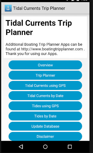
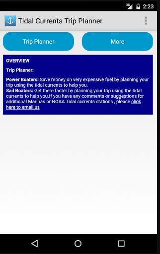
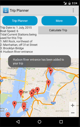
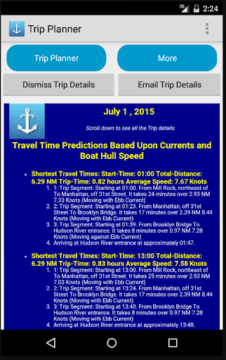
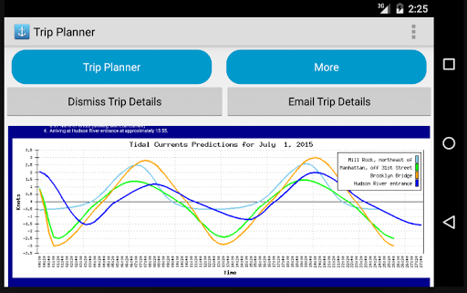
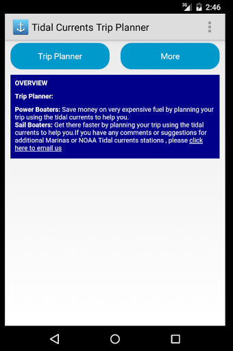
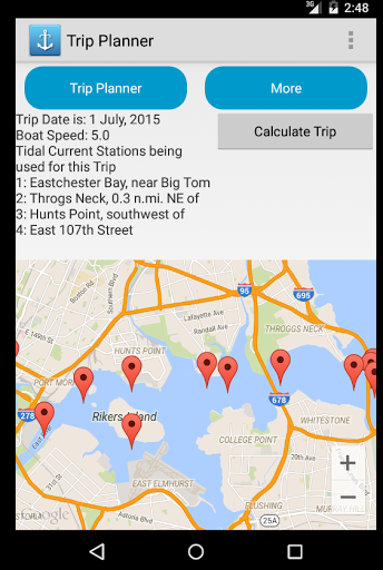
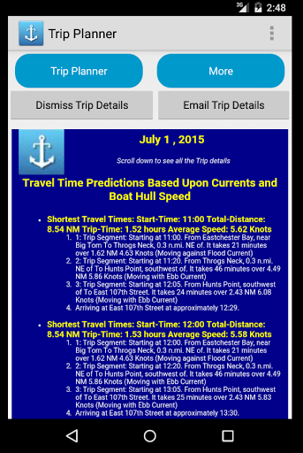
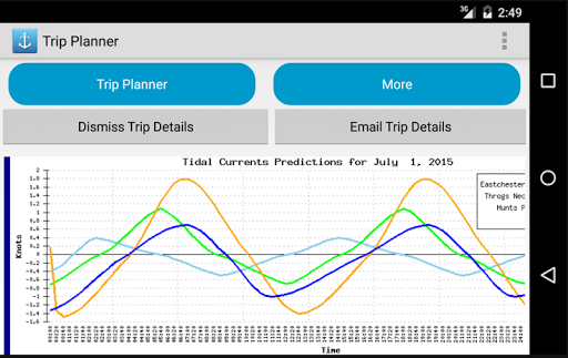
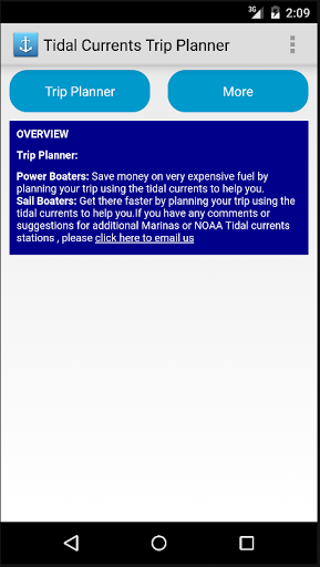
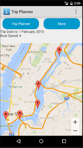
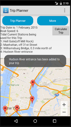
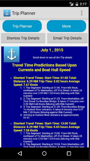
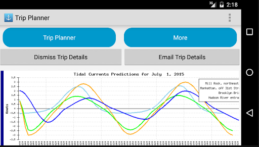
East Coast: This app contains a Boating Trip Planner for the east coast of the U.S. from the Florida to Maine using over 2,100 NOAA Tidal Current Stations. Click on this link to see a complete list of all NOAA Tidal Currents stations that we currently display: http://boatingtripplanner.com/noaa_list_all_stations.php WHY USE THIS APP? Save money on very expensive fuel and get to your destination faster by planning your trip using tidal currents. TRIP PLANNER OVERVIEW: • After selecting the date for your trip and your boat's cruising speed, you’ll then use the map to click on each Tidal Current Station map marker from your starting point to your ending point. As you click on each Tidal Current markers, you will see that station being added to the trip plan located above the map. After you have selected all your tidal current stations, you’ll click “CALCULATE TRIP.” (see screen captures below) • And now for the power of this app… You will be given a few choices on what time you should leave and what time you will arrive based on the tidal currents from the start of your trip to the end. Pick the quickest trip and save time and money on fuel! • The results will show you multiple times when you should start your trip and will estimate how long it will take you. • The tidal currents are plotted and displayed for you to verify the results. This helps you to fine-tune your next boating trip. Using GPS to find Tides (Hi/Low) at your Position: Using your Smartphone or Tablet’s built-in GPS, this app will find the two closest tide stations to calculate your present tide based on your GPS position. You can quickly refresh your boat’s tide based on the updated GPS reading by touching one button. Finding Tides (Hi/Low) at a Tide Station Based on Date: After selecting a date, you will see a single tide station's details. You can drag the map to display the desired region then tap a tidal station marker. A graph displays the 24-hour tide predictions for the selected day. A table is shown with high and low tides times Using GPS to find Tidal Current at your Position: Click on this link to see a complete list of all NOAA Tidal Currents stations that we currently display: http://boatingtripplanner.com/noaa_list_all_stations.php Using GPS to find Tidal Currents at your Position: Using your Smartphone or Tablet’s built-in GPS, this app will find the two closest tidal current stations to calculate your present tidal current based on your GPS position. You can quickly refresh your boat’s tidal current based on the updated GPS reading by touching one button. Finding Tidal Currents at a Tidal Station Based on a Date: After selecting a date, you will see a single tidal current station's details. You can drag the map to display the desired region then tap a tidal station marker. A graph displays the 24-hour tidal current predictions for the selected day. A table is shown with slack, peak ebb, and peak flood times.
More