In short
Ultimate US Public Campgrounds is an app for Android made by Toad Hall Enterprises. This is a great app for camping enthusiast. It helps to check phone.
Highlights
Amazing resource as I plan a three month roadtrip in the area
The regular updates and easy to use interface make this app a winner
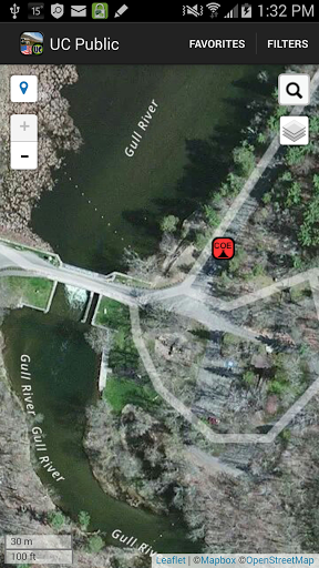
With Aerial View I can now see my choice and the road into it
A must for any camping enthusiast
Everything you need to find the perfect spot and connect to the park
Great convenience not having to check my phone or computer
Map feature seems to work very well
But it totally made up for it by helping us find a hidden gem
Very much enjoy the quick links at the top of the info boxes
It is a fantastic resource for anyone wanting to camp on public land
As soon as this app loses a data connection it becomes useless
If your looking for high priced camping this is not for you
Description
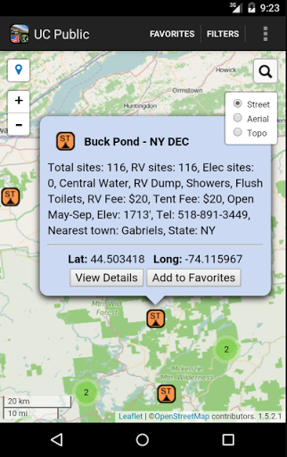
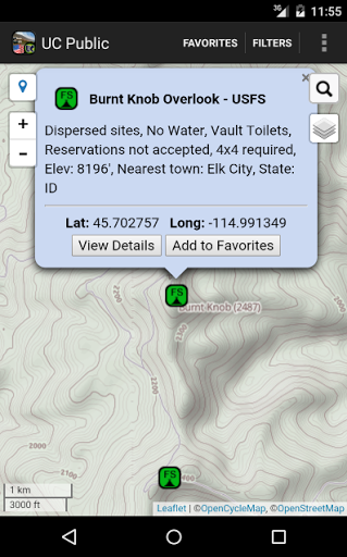
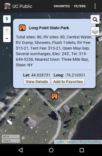
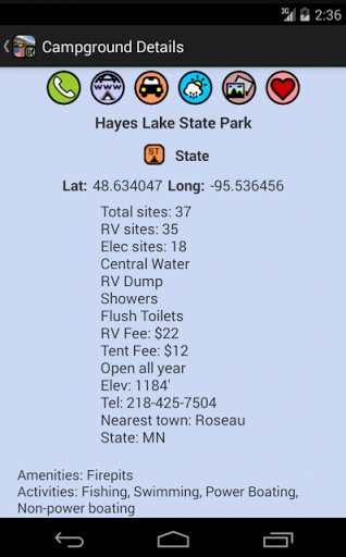
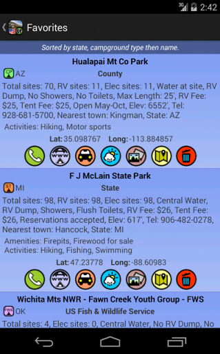
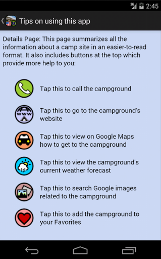
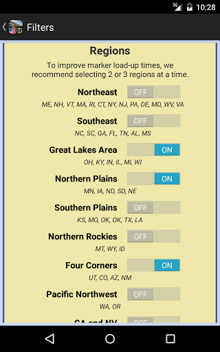
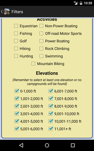
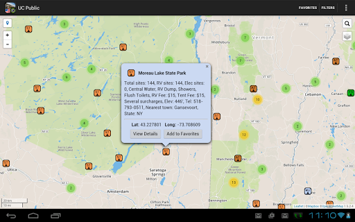
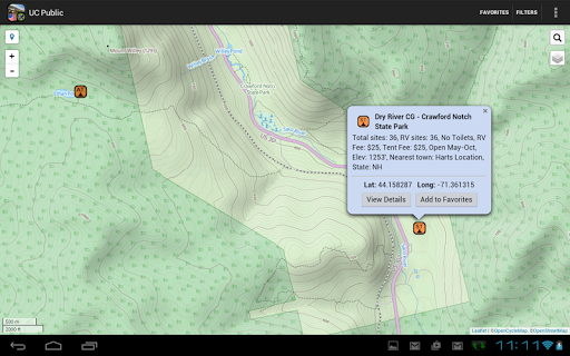
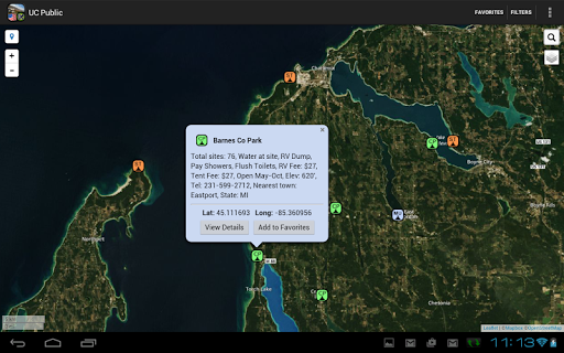
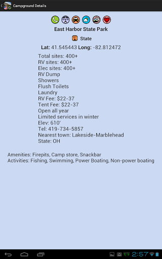
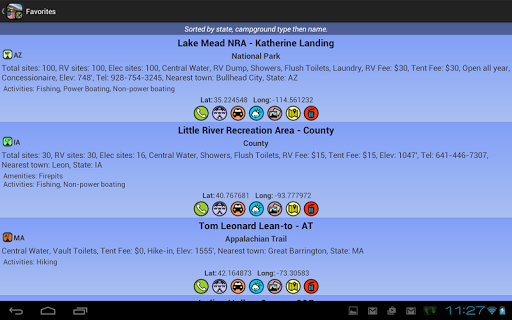
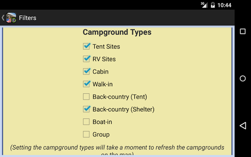
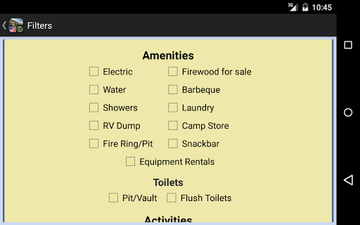
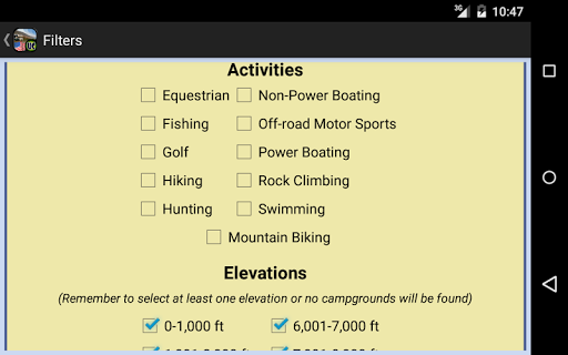
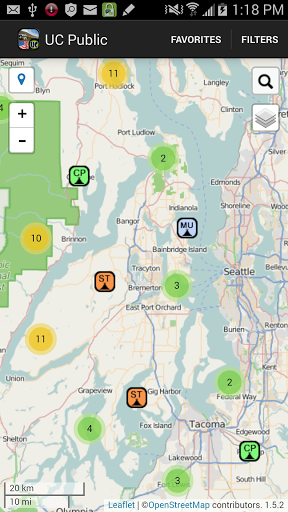
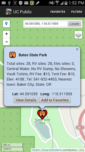
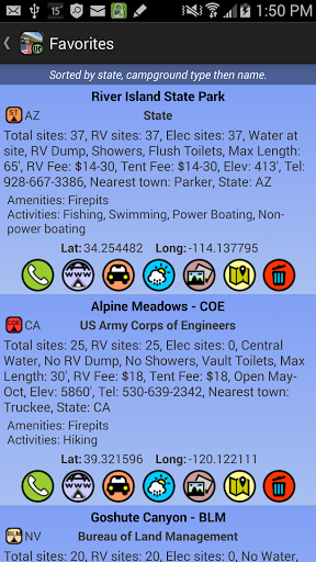
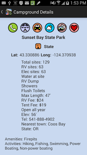
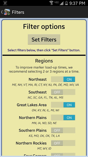
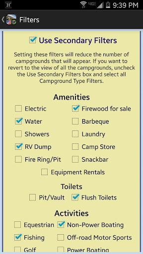
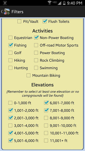
In this app you will find thousands of camping locations across the lower 48 United States, Alaska & Hawaii. The source of the data is the Ultimate US Public Campground Project, acknowledged as the most comprehensive single source for public campground information. Locations shown range from full-service campgrounds to boondocking sites with no amenities to back-country hike-in and boat-in locations. Filters allow you to select which types of campgrounds you want to see displayed on the map, such as Tent, RV, Walk-in sites, Back-Country Hike-in and Shelter locations, Boat-In, Group. or parks with Cabins and/or Lodges. Additional filters let you see camping sites with only the amenities and/or activities in which you are interested. A set of elevation filters and region filters are also included. Included are campgrounds owned/operated by towns and cities, counties, states, and federal agencies including the National Park Service, Army Corps of Engineers, Forest Service, Bureau of Land Management, Fish & Wildlife Service, Bureau of Reclamation, Department of Defense and Tennessee Valley Authority. Also included are locations operated by Native Americans, utility companies and non-profit organizations. This app does require internet access to work properly. The campground data is on your device as part of the app, but the map is loaded from the internet. When first opened, the app will be centered on your current location. From there you can scroll the map to view campgrounds in other areas or you can enter a city or latitude/longitude into the Search box and jump to that location. To get back to your current location, just tap the Locator icon. Campground icons are color-coded according to the "ownership"of that facility and also include an abbreviation, thus making it easy to pick out each type on the map. For example, Forest Service locations have a green icon with "FS"on it. Unique icons are also used to denote trail and river campsites, such as the Appalachian Trail and Idaho's Middle Fork Salmon River. Tapping on a campground icon will result in a pop-up balloon with all the info available for that location. You can tap on a Details button for even more information about the location, including links to its phone number, website, route planning to get you there, weather conditions and pictures of the campsite. You can also add a location to a Favorites list. The Favorites list organizes your saved locations by state and type. You can tap on a Favorite item and the app will jump you there on the map. The data itself is updated every month with new locations and corrections and additions to existing locations. The Play Store will automatically update your app with the new data. Want to see a preview of what the Ultimate Campgrounds is like? Check out our FREE "UC Military Campgrounds"in the Google Play store.
More