Galileo Offline Maps Pro - OSM based project for hikers & bikers traveling the wilderness is an iOS app from Evgen Bodunov.
Highlights
It the best GPS software in the world because saved my life
Easy to use and many features
Description
Go offline anywhere you want — offline vector maps and offline search for your better travel experience. Record your GPS tracks, bookmark your favorite locations and sync them between your devices.
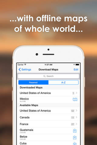
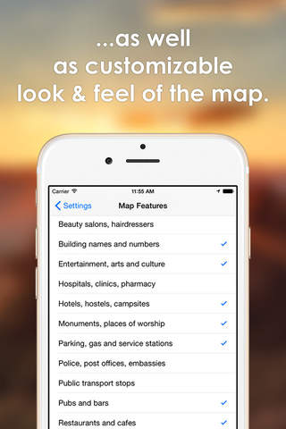
Offline Maps:
• Unlimited – there is no limit on the number of countries/regions you can download.
• Detailed and informative – because they based on OpenStreetMap.org data.
• Up-to-date and accurate – we update them monthly.
• Take up less space than others and work really fast – app uses GPUs in addition to CPUs to render vector maps.
• Changeable size of labels – large labels on maps is extremely useful while driving.
• Multiple languages support – map labels will be changed to the selected language immediately.
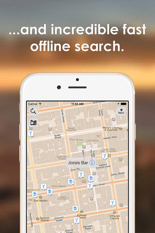
Offline Search:
• Incredible fast – results appear instantly as you type.
• It works in variety of ways – by object name, category or even by GPS coordinates.
• It finds objects in multiple languages – this will make your searching much easier than ever.
• No internet connection required.
Geo data syncing:
• iCloud and Dropbox sync supported.
• Any number of devices could sync simultaneously.
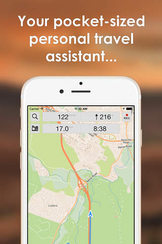
GPS Tracks Recording:
• Record your trips and export them as KML/GPX files.
• Monitor your real-time speed, distance and time traveled, as well as altitude right on the map during the trip.
• Beautiful gradients to visualise altitude and speed changes.
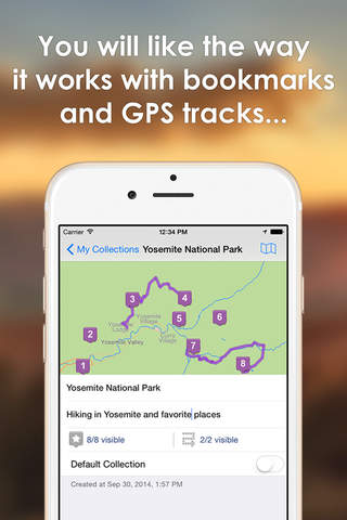
Bookmarks on the Map:
• Mark your favorite places on your maps and set points of interest for your next trip.
• Choose from lots of icons to assign to bookmarks.
• Store your bookmarks and GPS tracks in separate collections for a quick access.
Sharing Your Geodata:
• Share your itineraries from the app via Mail, Facebook and Twitter.
• Export them in the most common formats: KML & GPX.
Backing Up Your Data:
• Back up your collections to have the copy of data that may be lost or deleted by mistake.
• Restore data to your device from the backup you created earlier in one tap.
• Transfer backuped data to another iOS device or app
Offline Maps Import:
• Import previously created custom offline maps in .sqlitedb or .mbtiles format (use Mobile Atlas Creator, TileMill or SAS.Planet to generate offline maps).
And even more:
• Custom map sources support (including multi-layer sources)
• Different coordinate formats (including MGRS)
• Importing KML/GPX files into the app
• GPS filtering (accuracy and distance threshold)
• Bearing line to bookmark
• One finger zooming
• Measuring distance between two points on the map
• Works on slow iOS5 devices iPad 1 and iPhone 3GS
Continued use of GPS running in the background can dramatically decrease battery life.
Map data OpenStreetMap contributors.