In short
ROAM GPS:Recreation Maps&Tools is a free map app for Android made by onXmaps. It helps to locate new trails.
Highlights
Worked very well for locating my destination points
Best map app out there for hiking
Great for planning hikes and dicovering new areas
This app is amazing for locating new trails in my area
Working good on my Moto X 2nd generation phone
This software has the best hiking trails
Has great details in multiple map sets
I'm an avid outdoor enthusiast and love the map detail in this app
Helped me find great spa to camp and get blitzed
This app makes it easy to find new trails that I never knew existed
Tech support is very slow at returning email's
Deleted it right away and will use AllTrails Pro
Without european maps this app is nothing worth for me
Every time i click the layers it will force close every single time
Would no longer log in or let use app 3 days simply wasn't enough to evaluate
Description
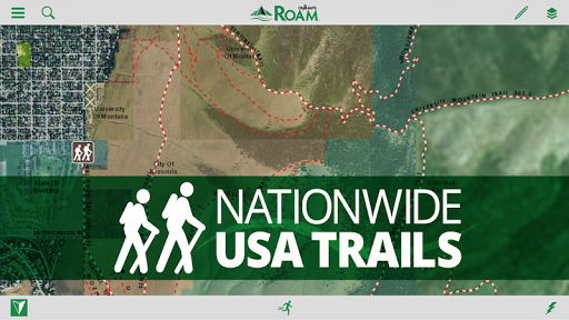
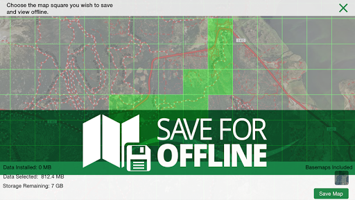
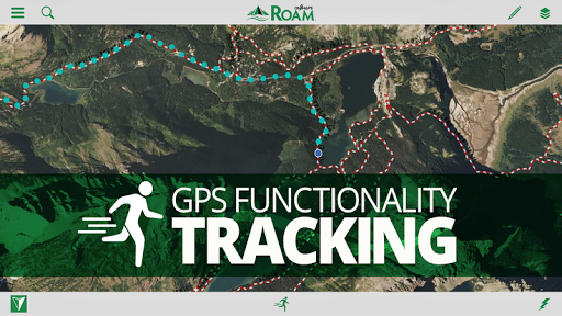
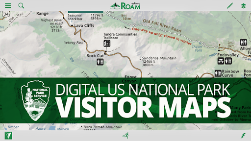
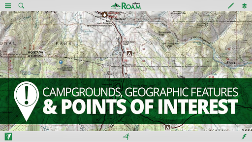
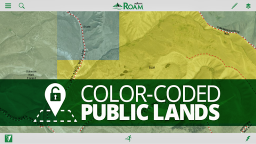
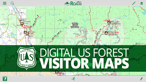
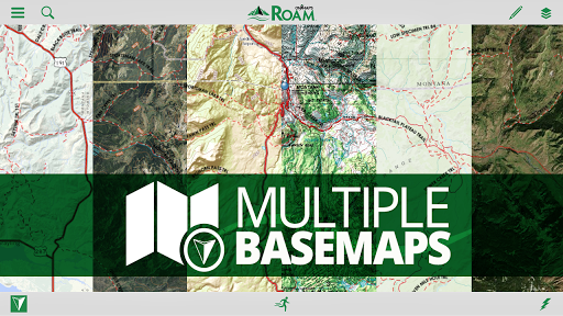
INTRODUCING THE ROAM APP BY ONXMAPS ROAM turns your phone or tablet into a handheld GPS with extensive outdoor map data! Find new places to recreate using the most complete public lands & open spaces maps ever created. Going out of cellular data coverage? No problem! Your GPS works even without cell service and you can save your maps and markups for offline use. •Turn Your smartphone or tablet into a powerful handheld GPS •Discover new trails by browsing the most comprehensive nationwide trails map ever created •Find Open Space with onXmaps’ accurate Public Lands data •We’ve combined all your paper maps into a much more customizable digital map suite •Turn Map Layers and Basemaps on and off to customize your maps for your favorite activity •See Recreation Access Areas and Water Sports Access Points •Switch between comprehensive Base maps including Aerial imagery, 24K topo, and Hybrids •Save Maps for Offline Use when out of cell coverage •Create Geotagged Photo Waypoints and Customized Waypoints •Auto-Sync and Share Waypoints, Tracks, Measurements, and Stats with your Team and between your devices FREE TRIAL While the App and many of it’s features are free. You will start a free Roam Nationwide and State Private Parcels trial when you install the App. This allows you to try our full app for 7 days. ROAM APP FEATURES MAP DATA FEATURES From mountain biking to kayaking, from the summit to the sea, if you love outdoor adventure - WE GUARANTEE there is time-saving map data in the ROAM app for you. Here is just a preview of the map options that ROAM puts right at your fingertips. •Public Lands: Nationwide Federal and State (the most accurate and complete nationwide dataset ever created) •City and County Open Space •Trail and Trailhead locations, names and numbers •Geographic and Recreational Point of Interests •Water Data •Weather and Radar •Campgrounds and secluded Campsites •Ski runs and lifts •National Park Service Visitor maps •National Forest Visitor Maps (save thousands $$$ on paper maps!) •Motor Vehicle Roads and Trails (MVUM) displaying National Forest System (NFS) Routes (roads and trails) open to motorized travel •Nationwide USFS Roads •Nationwide USFS Trails and Wilderness •USGS Gage Stations •USGS Snotel (snowfall measurements) •Wildfire Historic Perimeters •Active Fires •Private Landowner Names with Property Boundaries •And much more! BASEMAPS •USGS Topo (Quads) •Aerial Imagery •Imagery + Topo Hybrid •OpenStreetMap •World Topo •World Imagery •World Streets •USA Topo Maps •Ocean BaseMap GPS Functionality Right on Your Phone or Tablet •GPS Location •Mark Waypoints •Tracks •Compass Mode •View elevation profiles •Backtrack function to make sure you can always make it back to the vehicle safely TRACKING FUNCTIONALITY •Active track on/off •Track elevation profile MARKUPS AND DRAW TOOLS •Place Points on the map •Geotag Photos •Use Custom ROAM Waypoint Symbols •Draw Lines •Draw Shapes MULTIPLE DEVICES (my.onxmaps Cloud sync): •ROAM anywhere! One account gives you access across multiple devices •2 devices - Use on your phone and tablet •New phone? No problem. Simply log in to your account and access all your map content that is automatically saved to your account •Your tracks, photos, waypoints and maps are automatically synced to all your devices •Waypoints are automatically saved to the cloud. No more risk of losing your valuable waypoints if you lose your GPS or change phones SHARE VIA SOCIAL, TEXT, OR EMAIL •Tracks •Markups MEASURE TOOLS •Distances •Perimeters •Areas SEARCH •Search for nearby places •Points of Interest •Landowner Names AUTOMATIC MAP UPDATES •The newest map data is automatically streamed into your device with no cumbersome update process ‘USE SAVED MAPS’ MODE •Forces the app to use your saved maps when in areas of low cell signal •Saves on battery life Note: As with all mapping apps, continued use of GPS running in the background can dramatically decrease battery life.
More