In short
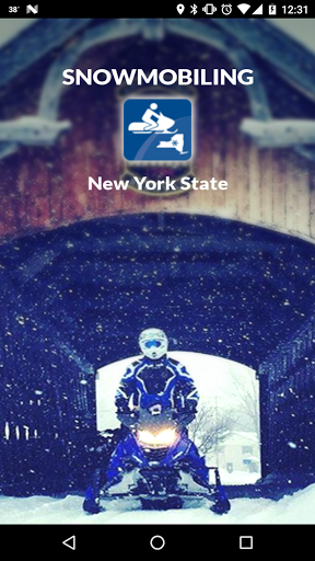
Snowmobiling New York State is a free snowmobile app for Android made by Mohawk Valley GIS.
Highlights
Adds a lot confidence and peace of mind to a trip
This app helps you plan trips to new places with minimal fuss
The best snowmobile app I've seen to date
Very accurate trails and GPS location
Linda and crew have a great interface now with the businesses and gas
Best money I spent on snowmobiling last year
And excellent support
Tons of great features
This app is great used it many times
And can be a veritable life saver if conditions get bad
Then I need to reload which is not fun with gloves on in the cold
Very frustrating please fix before the real snow starts to fly
Description
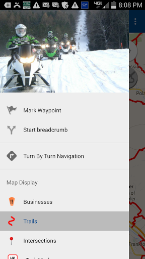
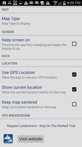
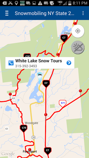
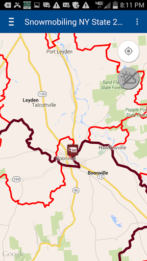
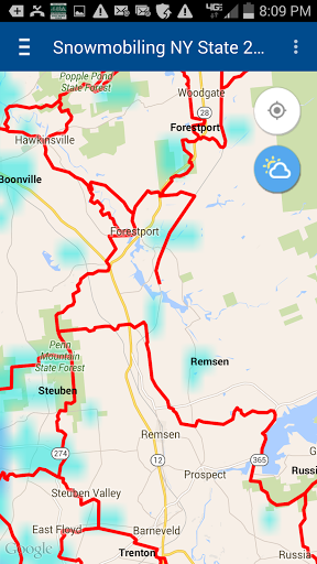
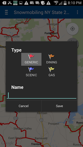
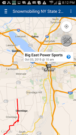
Our NY statewide trail app has been enhanced for your 2016-2017 season! Now with five types of Trail Conditions available as an in-app purchase! (Trail Conditions feature requires reception). All 45 counties worth of trails available without reception. Including Old Forge/Inlet trail system. Video demonstration on phone app page of NYSnowmobileWebmap.com website. Statewide coverage of corridor & secondary trails, club verified corridor, secondary and local trails included for NYSnowmobileWebmap participating clubs. Trail junctions and locally owned, snowmobiler friendly businesses included – find where to eat, get gas, parts and repair, or stay the night. We’ve added what you requested: turn-by-turn directions, more waypoint options, club events, Covered Bridge Challenge route and color coded trails, including on-road trails. Tap a trail pin, find out if it has been GPSed or not and what club maintains it. Contact the club if necessary. Business pins are category coded, tap for complete descriptions. Trails, trail markers and intersections available for display without reception across the state. Currently cached maps will also display without reception. No need to hassle with a paper map blowing in the wind. Going to an unfamiliar area? Enable GPS on your phone and never get lost! No need to try to figure out where you are, your phone app will show you relative to the trails and intersections. With or without reception! Capture your ride or plan out a route. Town names will display for better orientation if riding without reception for an extended time and your phone no longer has cached street maps. Don't miss out on all these features: • Old Forge and Inlet permitted trail system included • app centers on your current location • midseason trail updates automatically downloaded with reception, at your approval • complete statewide corridor and secondary trail coverage • local trail coverage for over 90 clubs • display current satellite GPS location • mark and save waypoints • capture and save GPS breadcrumb tracks, just tap the compass to start • turn-by-turn navigation (voice and visual) • display all trail data and businesses without reception, statewide • choice of street view or hybrid satellite view • display the current radar, with reception • create, edit and save routes • predominantly local, mom & pop businesses that welcome and cater to snowmobilers REMEMBER: Continued use of GPS running in the background can dramatically decrease battery life. Please be prepared. Don't wait any longer! Download our essential app today and know you will enjoy your ride anywhere you go in New York State. Think snow! Developed by NYSnowmobileWebmap.com/Mohawk Valley GIS. This app is data intensive (over 20 MB), be sure to enable wi-fi on your phone when using the first time to quickly load all 45 counties worth of trails. For more detailed information or to contact us with questions, please visit www.NYSnowmobileWebMap.com. Disclaimer: Please note that the trails in this app come from NY State in November of each year, but not all trails have been verified by the clubs. Also note that not all trails have been GPSed. Tap a trail pin to find out. Do not precisely navigate by following non-GPSed trail representations. MVGIS cannot guarantee the accuracy of the trail locations nor can MVGIS assume responsibility for the condition of the trails depicted in the app. Please use caution and common sense at all times when riding. Follow posted signs on the trails at all times.
More