Highlights
If you have a sailboat it is entirely helpful for planning trips
Superb weather forecasting app
Is great for me to get the wind speeds before days ahead
We use this app to check weather for flying cross countries
Best weather maps with best live temperature and cloud
Very Useful for seafarers
Very informative and highly beneficial for outdoor executives
Thanks for the developers
Very cool to see the weather and other stuff over the worldwide
App is awesome kudos to dev
Even worse there is no way to even save a default location
There third party app was crashing all the time
Not the location from the antenna or wifi network
Doesn't display correct location on Sony z5
It will no longer open the detailed forecast either
Inconvenient UI in changing days by selecting menu with many taps
I can't get detailed information for current location or any other
Description
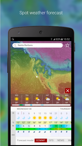
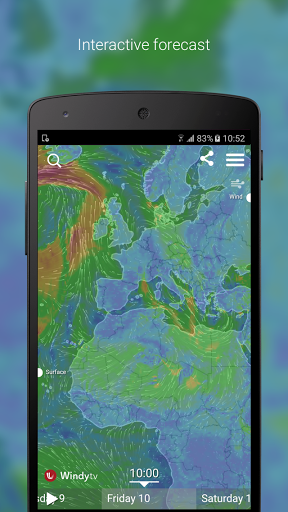
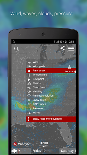
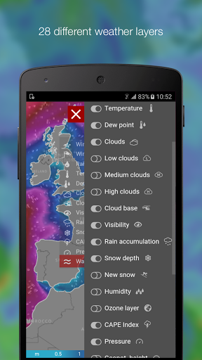
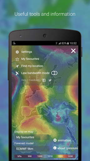
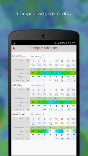
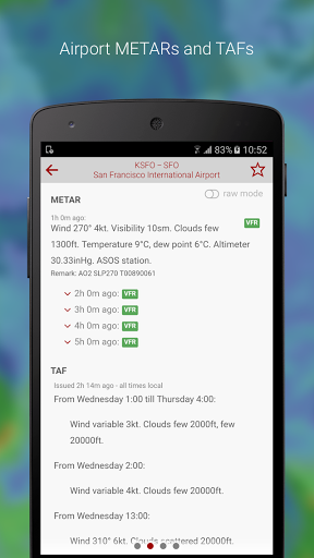
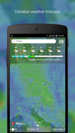
Windytv is intuitive, fast, efficient and the most accurate weather forecast app trusted by professional pilots, surfers, boaters, fishermen, kiters, storm chasers and weather geeks. Whether you are tracking a tropical storm, impending severe weather, planning a trip, or you just need to know if it will rain this weekend, Windytv provides you with the most up-to-date weather forecast around. Powerful, smooth and fluid presentation makes weather forecasting a true pleasure. 28 different weather layers From wind, temperature, pressure to Swell or CAPE index, with Windytv you’ll have all convenient weather layers just at your fingertips. All leading forecast models Compare all leading forecast models at once and make better decisions. Windytv offers global models ECMWF and GFS, plus local NAM and NEMS models. Map labels Windytv lets you display observed wind and temperature, forecasted weather, airports around the World, 1500+ paragliding spots or nearby webcams right on the map. Fully customizable Add your favorite weather layers to quick menu, customize color palette on any layer, access advanced options in the settings. All that makes Windytv the weather geek's tool of choice. Website Widgets and API Embed Windytv map or detailed forecast for any location into your website or blog post or build your own app on top of Windytv API. Features and data sources All leading weather forecast models: ECMWF, GFS by NOAA, NEMS and NAM 28 weather layers - see the list below 16 altitude levels from surface to 13.5km/FL450 Metric, imperial or custom units (m/s, mph, km/h, kt, bft, m, ft, mm, cm, in, hPa, inHg) Surface by Mapy.cz or Here Maps imagery Detailed forecast for any location (temperature, wind chill, wind speed, pressure, humidity, rain and snow accumulation) Detailed wind and wave forecast for any surfing or kiting spot Forecast model comparison Meteogram (temperature, precipitation, altitude cloud cover, wind speed and wind gusts) Airgram by Meteoblue, based on the NEMS model (wind and waves, wind speed, wind gusts, wind direction, weather, temperature) Webcams Nearby weather stations (observed weather- wind direction, wind speed and temperature) 50k+ Airports searchable by ICAO and IATA, including runway info, decoded & raw METARs, TAF and NOTAMs, meteogram, airgram, webcams and nearest weather stations 1500+ Paragliding spots Customizable list of favorites spots ...and many more List of Windytv weather layers • Wind • Wind gusts • Rain, snow • Temperature • Dew point • Clouds • Low clouds • Medium clouds • High clouds • Cloud base • Visibility • Rain accumulation • Snow depth • New snow • Humidity • Ozone layer • CAPE Index • Pressure • Geopot. height • Waves • Swell • Swell period • Swell 1 • Swell 2 • Swell 3 • Wind waves • Sea temperature • Currents Get in touch Join us at community.windytv.com to discuss weather related topics, report a bug or suggest new feature. Follow us on social media • Facebook: https://www.facebook.com/windytv • Twitter: https://twitter.com/windytvcom • YouTube: https://windy.tv/youtube • Instagram: https://instagram.com/windytvcom • Google+: https://windy.tv/googleplus
More

